


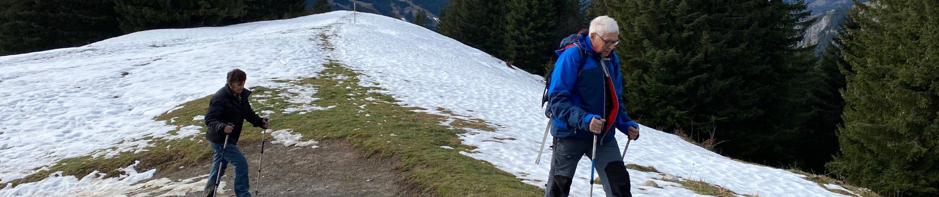
Lac d’Avouin

Derrendinger
User
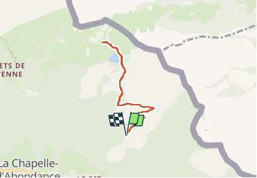

Length
7 km

Max alt
1725 m

Uphill gradient
293 m
Km-Effort
10.9 km

Min alt
1479 m

Downhill gradient
292 m
Boucle
Yes
Creation date :
2022-12-31 09:37:03.0
Updated on :
2022-12-31 13:38:22.664
2h29
Difficulty : Medium

FREE GPS app for hiking
 SityTrail
IGN / Geographical institutes
SityTrail Plus
The world is yours!
About
Trail Walking of 7 km to be discovered at Auvergne-Rhône-Alpes, Upper Savoy, La Chapelle-d'Abondance. This trail is proposed by Derrendinger.
Photos


Positioning
Country:
France
Region :
Auvergne-Rhône-Alpes
Department/Province :
Upper Savoy
Municipality :
La Chapelle-d'Abondance
Location:
Unknown
Start:(Dec)
Start:(UTM)
331522 ; 5129859 (32T) N.
Comments